Today you will begin a mapping project as you research the Age of Exploration! In this project, you will map all the major European trade routes using a mapping software called ArcGIS. You will then research these trade routes and write about them to include with your map. Follow these steps to complete your project:
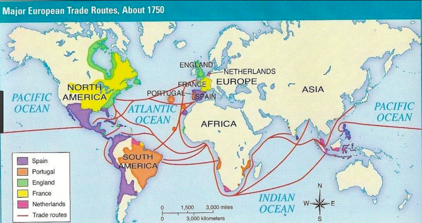
1. Study the below map
2. Open ArcGIS and learn the mapping software with Mr. Weimer
3. Split your screen with your blank map on one side, and the example map on the other. Use your mapping software to map a minimum of THREE European trade routes.
4. Take a screenshot of your map, and import it into Pages
5. Complete your writing
6. Print and display your work